-
Thuringia 2010 (2)
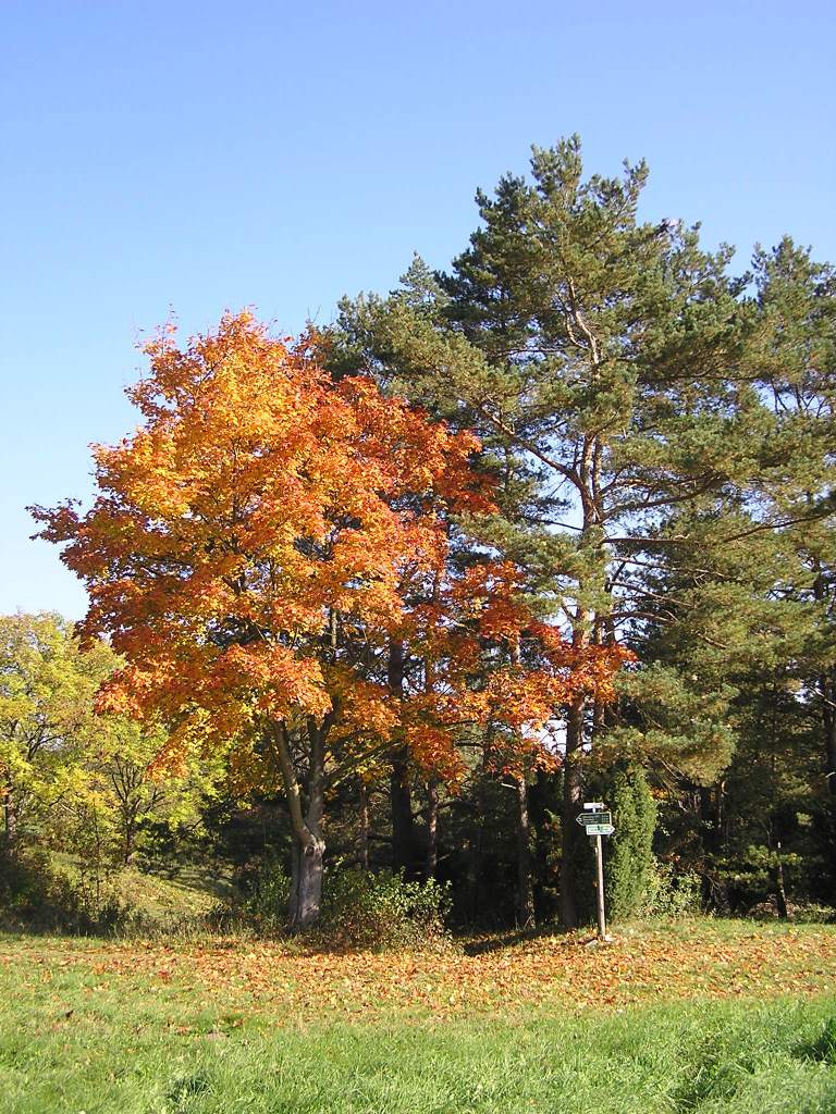
Autumn in Thuringia It was good to get out on the day, the colors were just great. And I guess I enjoyed the sunshine in October. Without the picture I would completely miss the memories of the day.
But what I’ve been thinking about now is how often I probably wasn’t outside back then, despite the nice weather. Sometimes it’s hard to get the motivation to take a short trip outside. And I remember days when I was later annoyed at myself that I didn’t get out. A few minutes ago I was thinking about riding my bicycle for another hour and made the conscious decision that I didn’t want to do that. A conscious decision is a significant improvement compared to some years ago, when it was a non-decision. But, now that I’ve written this post, I’ll change my mind again and see if I can find some sun.
-
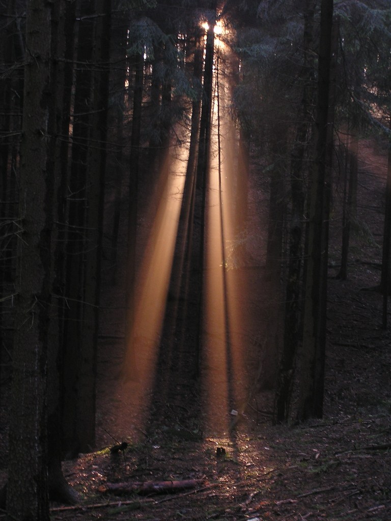
Ore mountains 2005
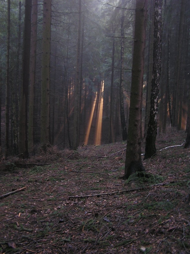
A few rays of light come through the dense forest. Maybe we should have dug for the treasure there.
-
Thailand 2020
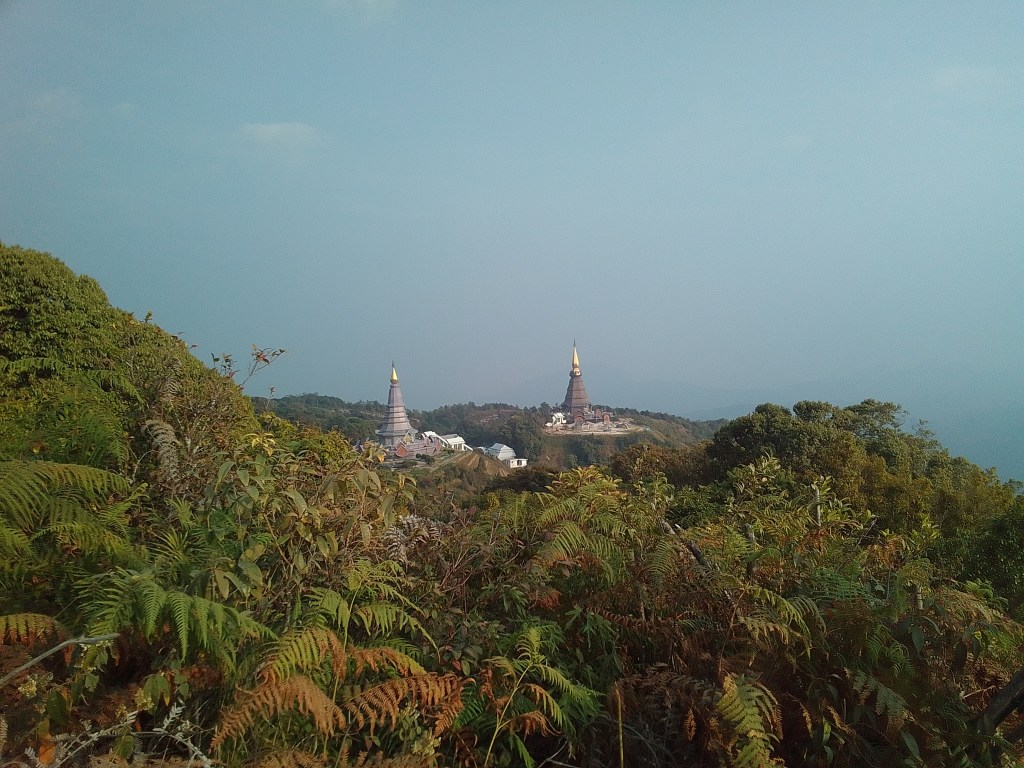
View of the Great Pagodas Nabhapolbhumisiri and Napamathanidol from the Kew Mae Pan hiking trail. Working days at the telescope in Thailand were always intense. The instrument and data analysis were improved during the day and then tested on stars at night. But luckily the boss didn’t want to work 12 hours every day either, so we also did small activities, such as the hiking trail to the Kew Mae Pan viewpoint. It was a bit unusual that we needed a local guide for a well-developed hiking trail, but it was good to have them for explanations.
-
South-Tirol 2012
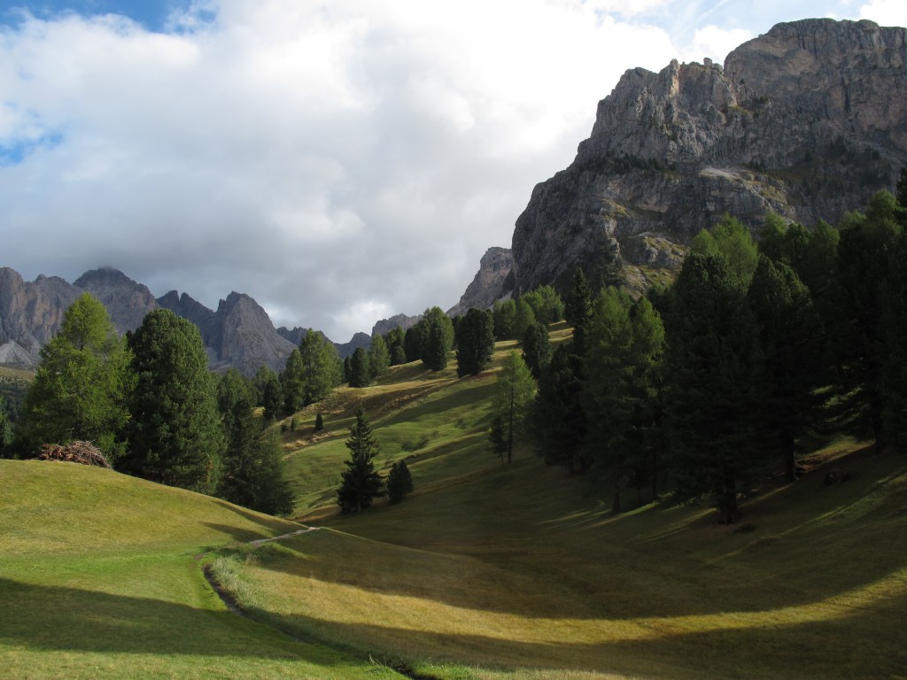
Dolomites near Selva-Wolkenstein (South-Tirol, Italy) What do you do for the first hike on vacation? You start walking and see where you get to. At some point you have a goal and you can easily reach it. And because you still feel fit, everything is so new and interesting, you think you can go a little further on the way back. So we did on our first hike 1600 meters altitude in 25 kilometers. And then had sore muscles for five days. But it was still nice 🙂

Elevation and speed profile of the hike -
Maui 2012 (2)
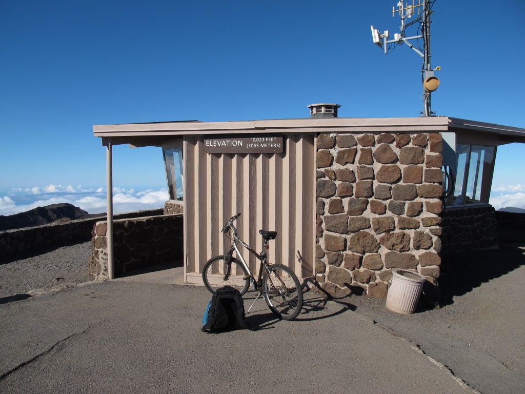
The bike on Haleakala, the highest mountain on Maui, Hawaii. The last transit of Venus took place in the summer of 2012. As part of this, I had the chance to take part in a workshop that included observing the transit. The accommodation for the workshop was at 1000 meters, on the slopes of Haleakala. And why use a car when you can also rent a bike. It was a challenge with luggage, but that didn’t stop me from trying to get to the summit the next day (I had planned a free day in reserve). I was fit at the time and actually made it up to the top. I’ve never cycled that high again, but I’ve managed to climb more meters on other tours.
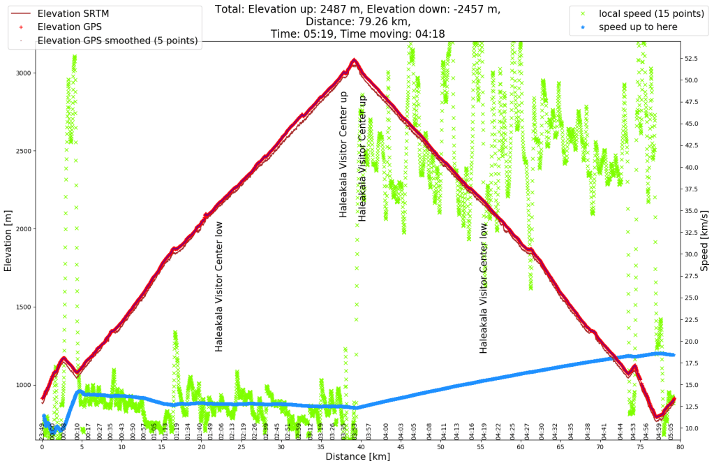
Altitude profile (red) and speed profile (green and blue) 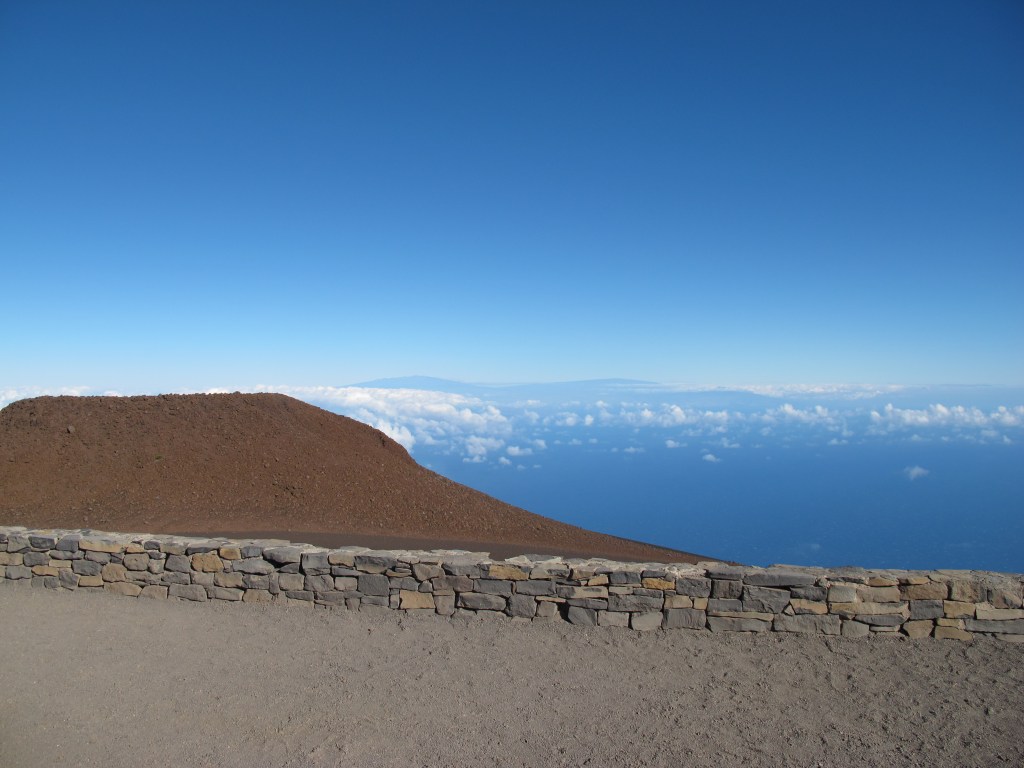
View from Haleakala, Maui, over to Mauna Kea and Mauna Loa, Big Island, Hawaii -
Norway 2014 (11)
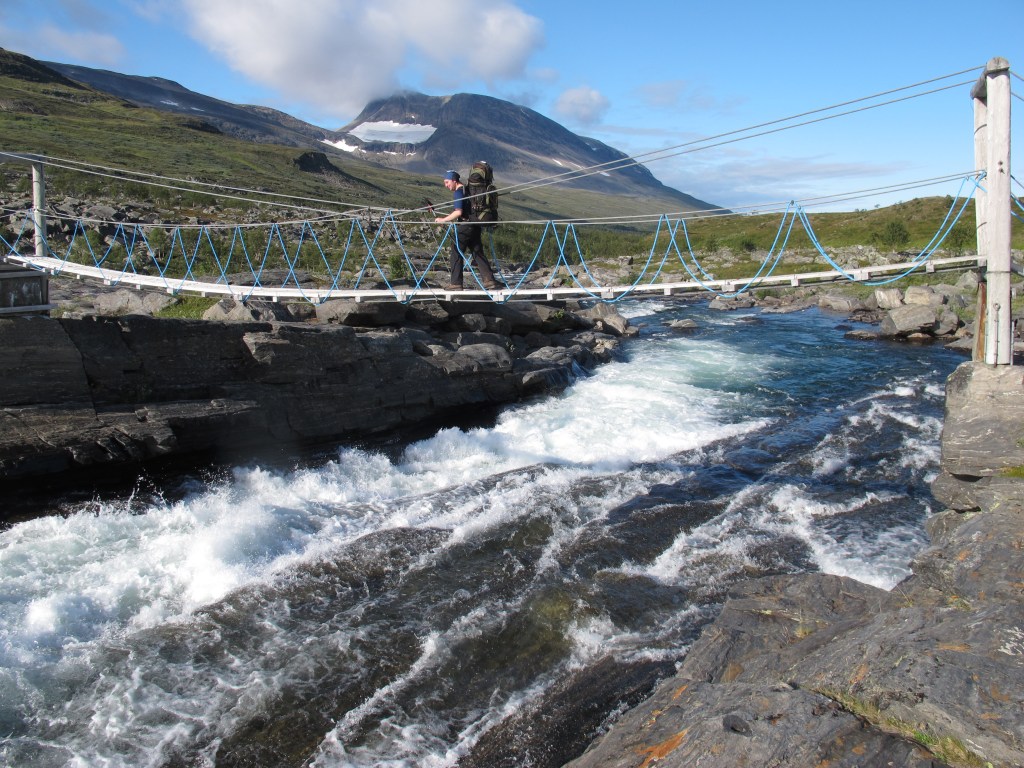
The bridge over the Rostaelva river at the Rostahytta (Norway) We have only seen so much water with so much speed at this point on our hike through northern Norway. So it was good to have a bridge. Probably not everyone feels comfortable when crossing because it consists of a lot of nothing.
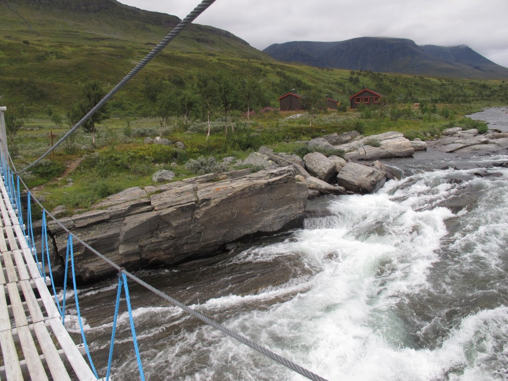
The bridge over the Rostaelva river with the Rostahytta in the behind In terms of weather, you can see the change to good weather between the two images. On the afternoon of our arrival at the hut it was still cloudy, the next morning it was much sunnier.
-
Ore mountains 2012
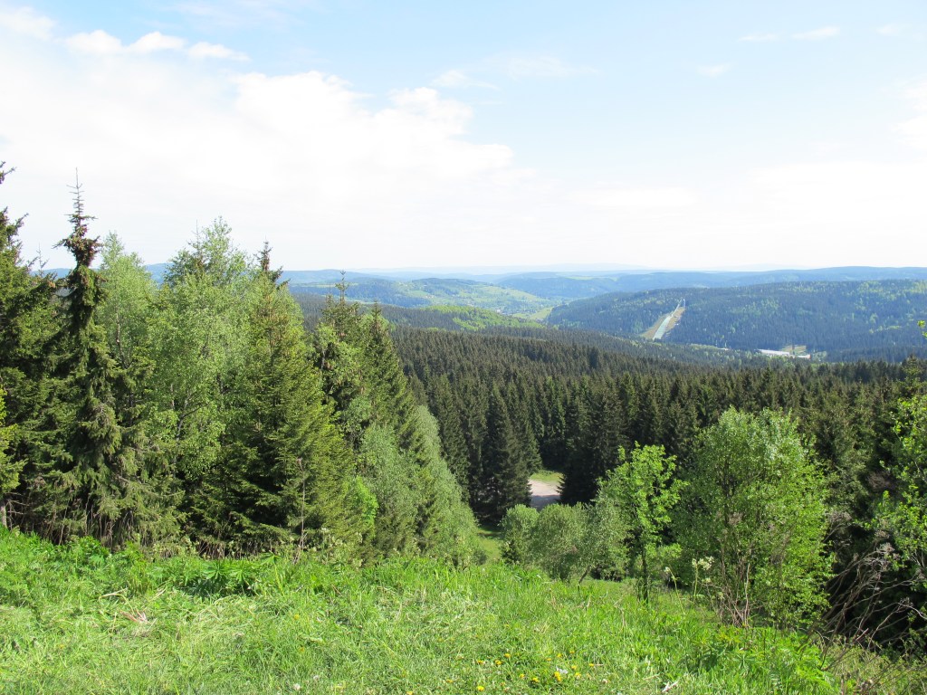
View from the Schneckensteinhalde (old mining hill) to the Vogtland Arena and over the Ore Mountains/Vogtland A multi-day hike through the Vogtland and Erzgebirge in Germany gave us this fantastic view at almost 900m altitude. The hike was almost exactly 10 years ago. I probably didn’t have a lot of emotions on the trek, as few details have stayed with me to this day. I still remember a lot of the area around the Schneckenstein from childhood memories 15 years earlier, of arriving in Aue because the backpack started to hurt, and of a problem with the trains on the way to the start, but a lot of memories in between are missing. I’m still sure, the hike was good 🙂
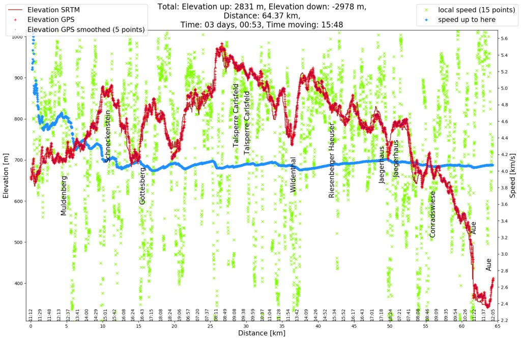
Elevation profile and speed profile of the hike -
England 2020 (2)
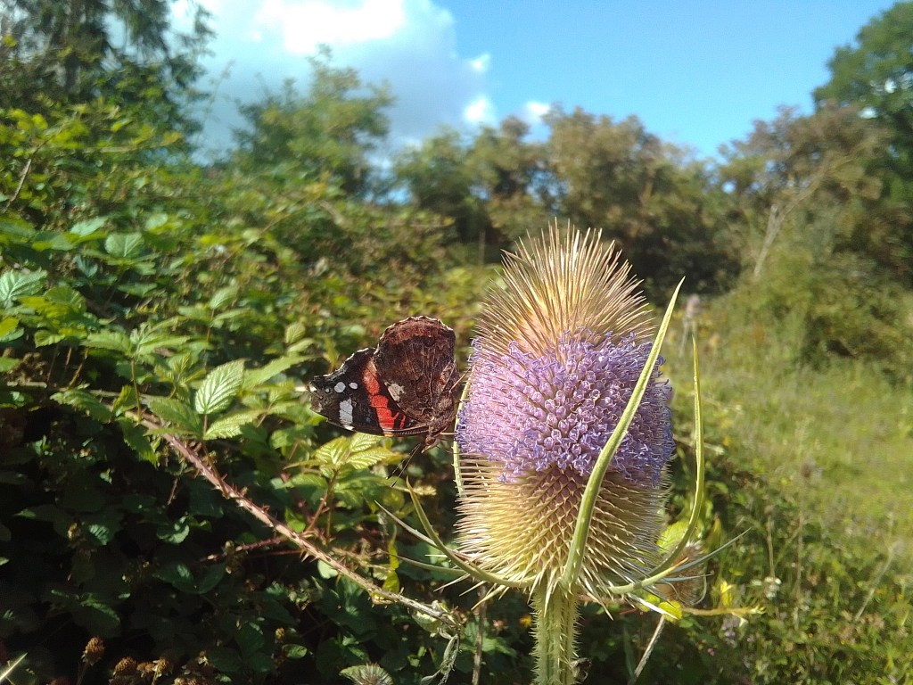
Butterfly and thistle This photo was taken on a hike with a friend. At first I just found it interesting that the thistle only has one ring of flowers, the upper and lower ones had already fallen out. Then, when I saw the butterfly, I knew I had to take a picture (it was more a must than a want. Slightly compulsive, however there are far worse compulsive behaviors). My friend then also had fun, as similar like on other hikes before, I stood on an ant nests (not a heap), so after the photo I hopped around a bit to shake the ants out of my sandals.
-
Thailand 2018 (2)
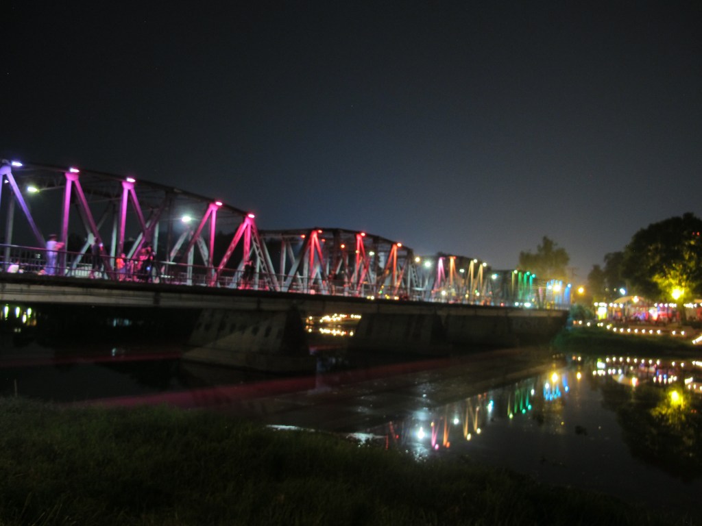
Khua Lek (Iron Bridge) over Mae Nam Ping river, Chiang Mai, Thailand My first business trip to Thailand was planned at short notice and as I and a friend had arranged to visit me in England, I wasn’t able to stay as long as I (and the project) had hoped. But it was still great, I mean how lucky to be able to travel to other countries for work. And the nice thing was the extra contact with the locals, and so I got a city tour on the last evening, traditionally without a helmet on the back of the moped.
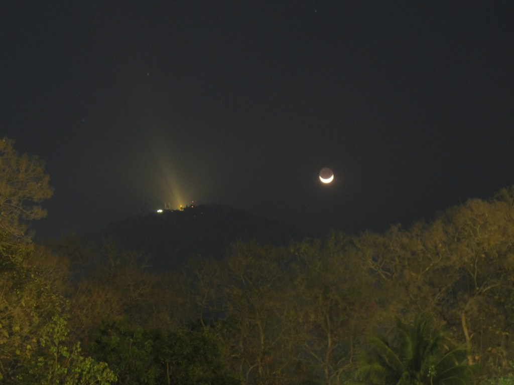
Moonset next to the temple Wat Phra That Doi Suthep, taken in the park of Chiang Mai University, Thailand -
La Palma 2014 (7)
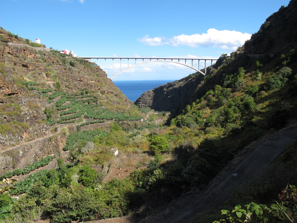
Tilos Bridge over the Barranco del Aqua near Los Sauces, La Palma, Spain After my second weekend bike tour on La Palma (described in La Palma (6)) on Saturday, I was already back on my bike on Sunday. I had sent the bike from Germany to La Palma and had to do without it for 3 weeks, apparently I then tried to make up for the bike withdrawal. In any case, I was much fitter than now that I’m writing about it, I can’t imagine so many meters of altitude on two days in a row at the moment. After heading south yesterday and heading west last Sunday, with only sea to the east, the logical conclusion was to head north this time. I also enjoyed this tour, so many views and experiences to take in. At the end I was really happy when it was almost all downhill from Puntallana.
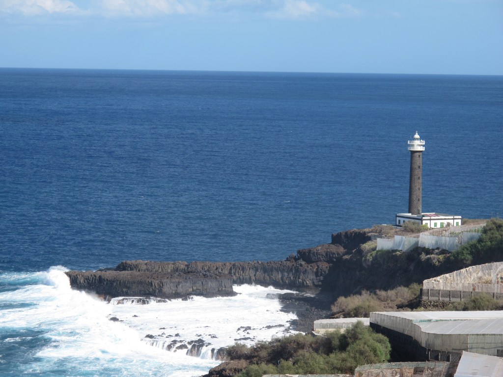
Faro de Punta Complida in the north of La Palma, Spain. 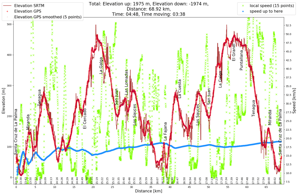
Elevation profile (red) and speed profile (green) of my bicycle tour. 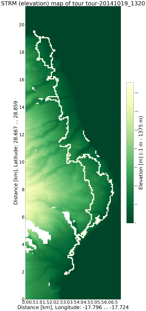
Geographic map using the STRM data with my route, created with https://github.com/ronnyerrmann/cycle_logging. The deep valleys are clearly visible in the data, the amounts of bends not so much.
-
Subscribe
Subscribed
Already have a WordPress.com account? Log in now.
