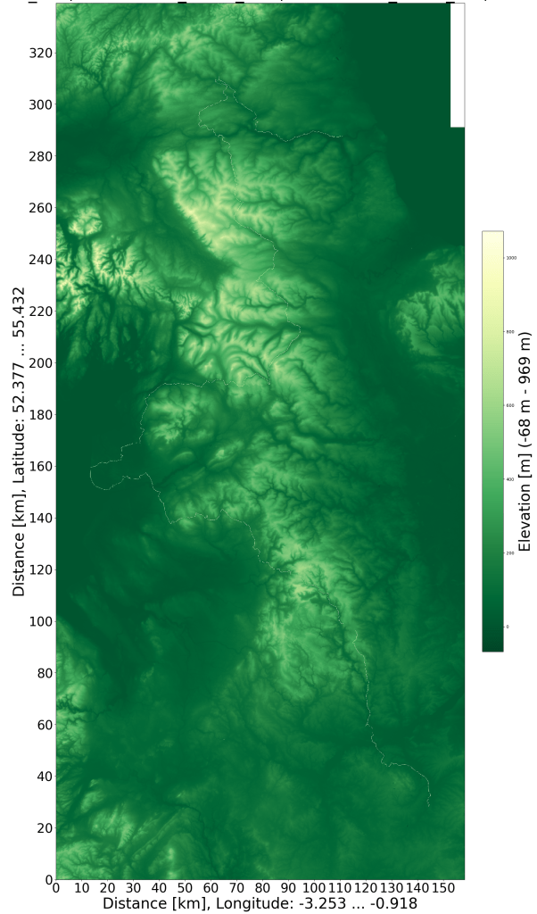
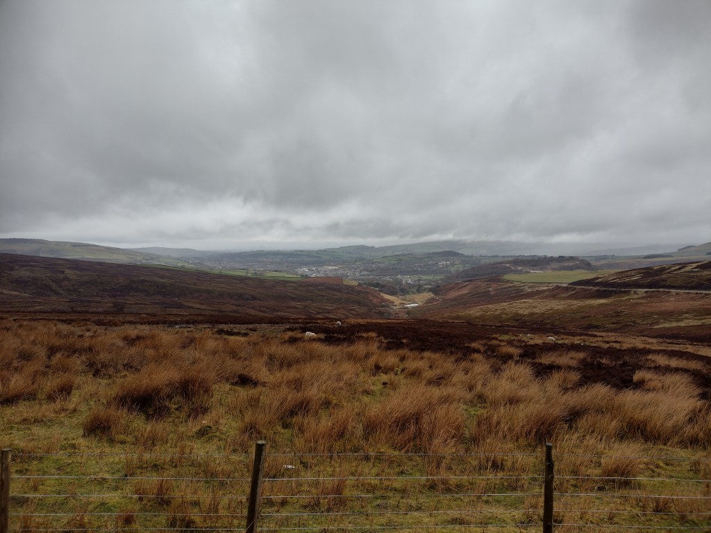
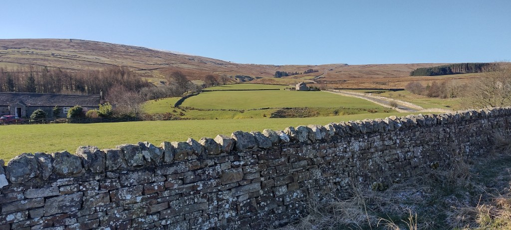
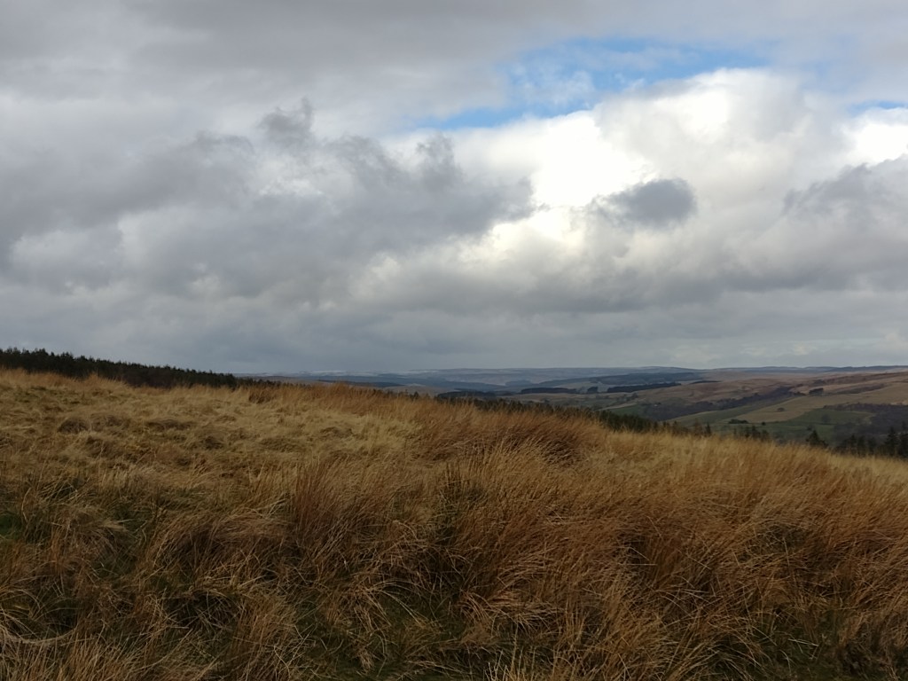
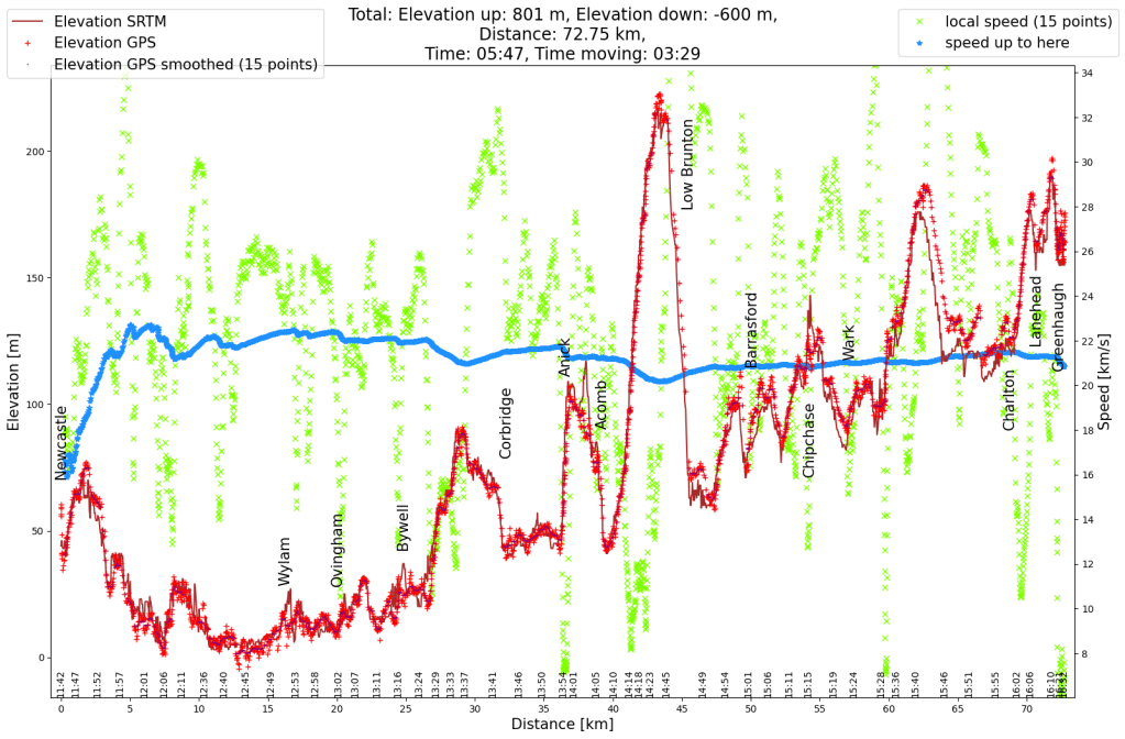
To distract myself from the annoyance of the headwind, I spend some time thinking about why it is so annoying. The first thing to notice is that there are far more headwind than tailwind trips. This is due to the fact that one si going forward, so wind from the side also feels like a headwind. And depending on the angle between the wind and me, as well as the speed difference between the wind and the cycling, even a slight tailwind can still feel like a headwind. When there is no wind, it still feels like a headwind.
Second, a headwind requires much more strength and energy than you get back from a tailwind. The reason for this is that the drag resistance is proportional to the square of the (relative) speed. From here on I only look at the part of the wind that comes from the front, e.g. the real headwind component.
Assuming that the other friction forces (rolling and sliding friction) are exactly balanced by the wind at 12.5 km/h tailwind, i.e. I am neither slowing down nor getting faster, I can define this force as a unit of friction. (I didn’t measure it exactly, maybe it’s a few km/h more, maybe a little less.) If I cycle at 12.5 km/h in no wind, then I have to apply two units of friction. At twice the speed of 25 km/h there are already five units of friction (2 squared plus 1). With a tailwind of 12.5 km/h and 25 km/h on the bike, it’s down to only two units of friction again. If the wind blows twice as strong and I am therefore exactly as fast as the wind, there is one unit of friction left and only when the wind is blowing at 37.5 km/h from behind do I no longer need to exert any force to move forward. So between 12.5 km/h and 37.5 km/h with a tailwind I only save two units of friction, in case of no wind, between three (67%) and five (100%) units can be saved.
Let’s look at the headwind situation. At a cycling speed of 25 km/h without a headwind, I have to apply five units of friction, as shown above. With a headwind of 12.5 km/h it is already ten units (3 squared plus 1), i.e. twice as much, or 200%. At 25 km/h there are 17 units of friction (4 square plus 1), more than three times as much, and at 37.5 km/h headwind there are 26 units of friction (5 square plus 1). Compared to no wind, I would have to apply 5 times the force. Compared to the savings in the other direction, this extra effort is huge. And that’s why headwinds feel so much worse than tailwinds. I do my commute at about 80% of my maximum strength, I think, which means I slow down very quickly when there’s a headwind because I just can’t produce twice as much or even more strength.
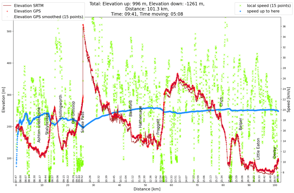
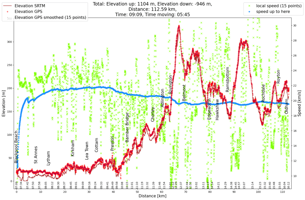
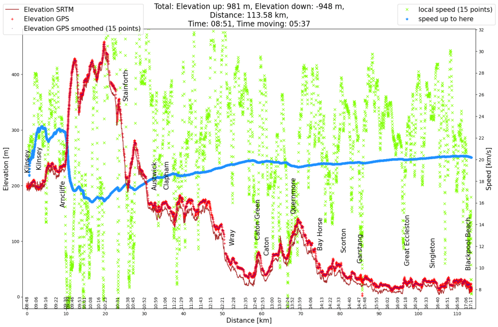
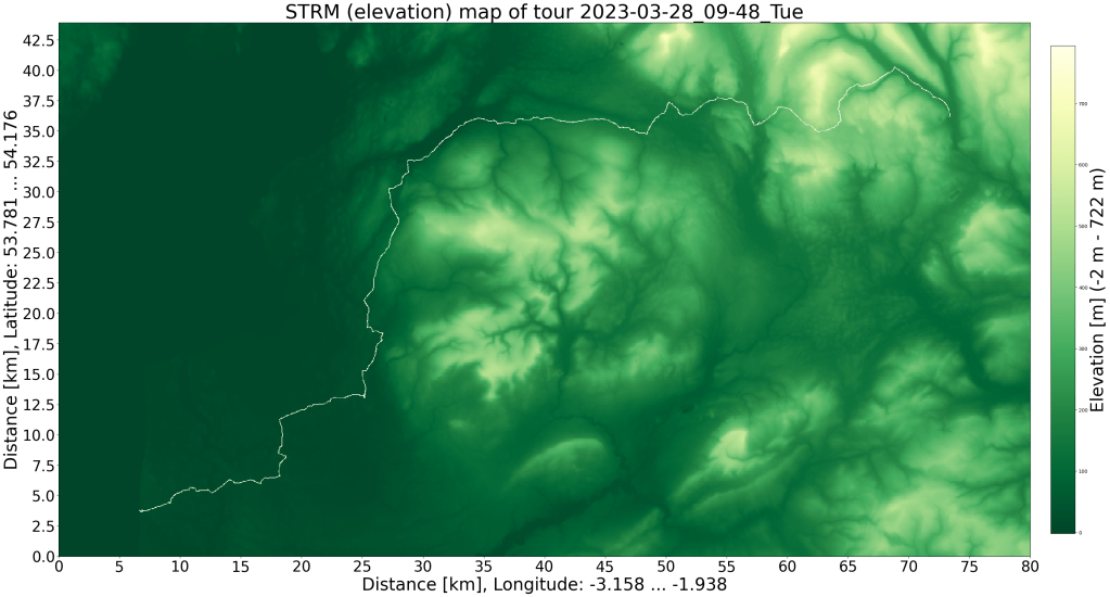
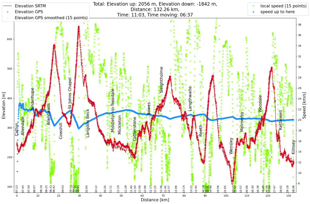
Let’s assume I keep the force the same and adjust my speed to the wind so that I stay at five units of friction. This means I would maintain a speed difference between the bike and the wind of 25 km/h. What would that mean for the duration of my commute if it took me 30 minutes with no wind (my commute to work is 12.5 km long). The table lists the tailwind (TW) and headwind (HW) speeds and duration (min, in minutes).
| Wind speed km/h | TW km/h | TW min | HW km/h | HW min | Total min |
|---|---|---|---|---|---|
| 0 | 25 | 30 | 25 | 30 | 60 |
| 5 | 30 | 25 | 20 | 37.5 | 62.5 |
| 10 | 35 | 21 | 15 | 50 | 71 |
| 12.5 | 37.5 | 20 | 12.5 | 60 | 80 |
| 15 | 40 | 19 | 10 | 75 | 94 |
| 20 | 45 | 17 | 5 | 150 | 167 |
| 25 | 50 | 15 | 0 | very | long |
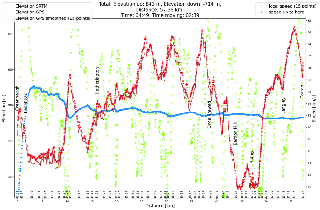
As long as I’m not lucky and the wind turns in the right direction over the course of the day, wind always means a longer overall journey time, with a wind of just 15 km/h it’s already 50% longer. The data in the table is somewhat idealised, due to potholes and vehicles parked on the road, as well as natural reasons such as intersections and pedestrian crossings, an average speed of over 30 km/h is not feasible. On the headwind side, it helps that the wind is weakened somewhat near the ground by hedges, houses, trees, hills and roads that are not exactly straight. One can also reduce your own cross section slightly, which also reduces wind drag. I also think that I put in a little more effort against the wind and therefore it doesn’t take quite as long.
There are more things to consider about this idealised way of calculations, for example the rolling and sliding friction apply per distance, which means that at higher speeds you have to work against more friction in the same time.
My speedometer states I burn about 35 kcal (kilo calories) per kilometre. Assuming this measurement was done with no wind, my energy consumption doubles with a 12.5 km/h headwind. 35 kcal is 145 kJ (kilo-joules). The energy to lift something is calculated as m * g * h (mass times gravity of earth times height). To lift myself and bicycle one meter, I need about 850 joules or 0.85 kJ. Instead of facing a kilometre headwind, I would rather ride 150 meters uphill. After that it goes downhill again!