England cycle trip 2023 (2)

Still very wintry landscape in Northumberland (England) near Bellingham. The nice thing about cycling uphill is that one can see more and more of the landscape. In this case the snow-capped mountains of southern Scotland are visible in the far distance.

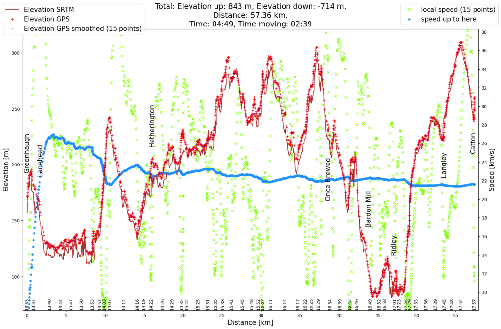
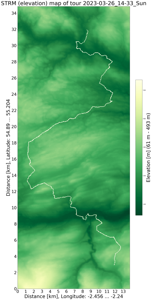
I traveled to Northumberland (in the north of England, almost on the Scottish border) for an event at the end of March. The week after the event I took leave to explore a little more of England. This is the first day (half day) of the bicycle tour.

It started in the valley which was already quite green. Apart from daffodils, there was very little spring in sight. But at least it was 8°C, so I could go without gloves. For most of the day I followed bike route 68, which took me to remote areas among many flocks of sheep. That was exactly what I wanted, a relaxed bike ride without being bothered by traffic. The small roads were in good condition (precisely because there is so little traffic on them). I saw a few motorbikes (due to an event) but other than that it was very quiet.

Somewhat surprisingly, the surface changed from asphalt to gravel on cycle path 68. But the path was still in good condition for most of the way, only in a few places the very wet March was noticeable. And it got very quiet, for the next hour I saw two vehicles, otherwise it was deserted.

After a last hill I reached asphalt again. The rougher ground and the hills demanded more energy at 5 p.m., I was able to enjoy the meal with a great view. It was only a bit wet to sit down, but I was sitting for the two hours before that in the bicycle anyway.

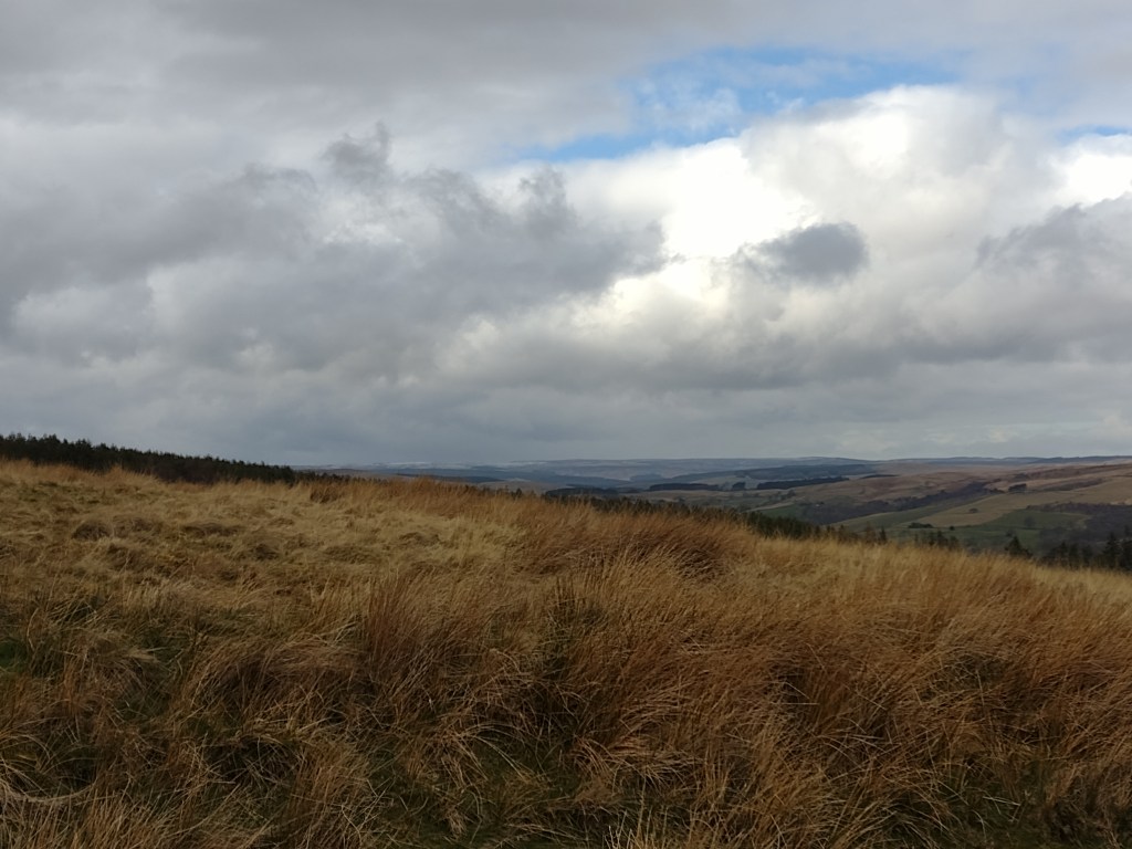
I loved the landscape, boggy, hilly, stone walls, meadows and a few trees.

Countryside near Once Brewed (I like the village name). The folding of the mountains has left an interesting landscape: steep edges of the mighty rock strata to the north and relatively gently rising plains to the south. This was part of Hadrian’s Wall, a Roman fortification against the Scots. A little later I passed the Vindolanda Fort.

I thought all I had to do was head down the valley and then maybe a few yards up the River Allen to get to my accommodation (I booked that same morning when it was clear when I could roughly leave). I should have checked the altitude difference on http://www.opencyclemap.org/. I crossed the river Allen at the lowest part of the day’s route, but before the accommodation I also had to cross the highest point of the day. So I didn’t arrive until 7 p.m. (and about an hour later than planned), but thanks to the time change, the sun hadn’t even set yet. And I arrived before the shower of sleet.

Elevation profile of the Northumberland cycle tour. It's a hilly landscape.
Elevation profile of the Northumberland cycle tour. It’s a hilly landscape.
SRTM relief map with GPS data

Leave a Reply

Fill in your details below or click an icon to log in:

WordPress.com Logo

You are commenting using your WordPress.com account. Log Out /  Change )

Facebook photo

You are commenting using your Facebook account. Log Out /  Change )

Connecting to %s

%d bloggers like this: